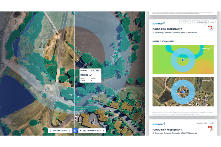

In its annual customer event Nearmap NAVIG8, the company revealed that it will launch automated roof condition assessment, fire risk assessment, flood risk assessment, and AI insights for natural disasters on Nearmap AI.
“Nearmap has swiftly transitioned from selling individual products underpinned by world-leading technology to providing an irreplicable, integrated solution-stack of location intelligence data, insights, and tools,” Don Weigel, senior vice president of product at Nearmap, told the NAVIG8 participants.
“In this way, organisations can rely on Nearmap to provide a trusted, end-to-end solution of location intelligence technologies and aerial imagery to help them work smarter, better, and faster. Nearmap is the only company that owns the entire technology stack for location analytics, including camera technology, image capture, processing, data and content, delivery, and machine learning capability. This enables us to be agile, innovative, and responsive to our customers’ needs.”
The Nearmap AI platform is built on a rich layer of content that uses machine learning to turn high-resolution aerial imagery into information and insights, creating one of the most accurate and richest AI offerings in the market.
The fifth and latest generation of the platform is enabled by a new deep-learning model trained on a much larger data set. It includes performance enhancements to existing layers and five new AI packs that bundle the AI layers into products for different use cases.
Commenting on the platform’s latest version, Nearmap chief technology officer Dr. Tom Celinski said: “The fifth and latest generation of Nearmap AI offers more than high-definition vector maps and additional automated location insights. It also serves as a powerful platform for a suite of new AI-derived products and technologies that will transform how organisations gain data and insights to make better decisions.”
