
Aerial imagery technology, driven by artificial intelligence (AI), is one way the insurance industry is responding to the increasing severity of fire and flood events. Insurers, loss adjusters and tech firms are using this data to help quicken response times to nat cats and speed up claims processes. The latest tech in this area is one focus of the upcoming Claims Leaders Summit.
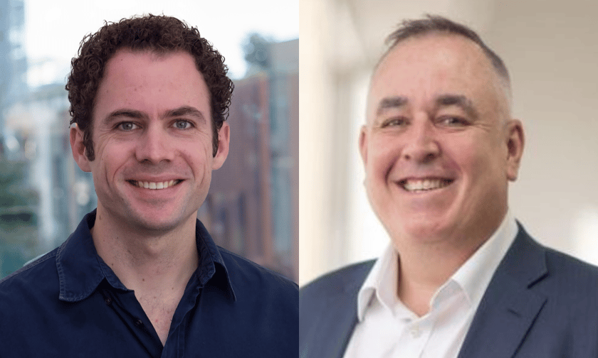
“Aerial imaging technology is especially helpful in assessing complex losses, such as large fire or water damage claims,” said Matt Donnelly (pictured right), head of specialty for Crawford & Company (Australia).
Donnelly described a range of ways it can help at all stages of a claims process.
“It facilitates precise evaluations of buildings, contents and insured stock and assets, as well as identifying storm or hail damage to roofs and maintenance-related damage,” he said.
The way aerial imagery can compare historical roofing damage to any current damage can determine claims that are “potentially ineligible,” said Donnelly.
“It also helps us to determine whether access to a specific property or building is feasible during a flood event,” he said.
For example, Crawford is using a virtual inspection tool that can be attached to drones and make 3D scans and measurements. Donnelly said this is proving particularly useful for complex roof assessments thanks to its aerial views and precise measurements.
“The internal and external dimensions provided by this tool enable accurate scopes of work, price verification and addressing potential underinsurance issues,” he said. “The immersive virtual imagery streamlines the process of creating repair scopes, allowing us to work more effectively.”
The other advantage is how aerial imagery allows insurance firms to more affordably assess property damage that is hard to reach - even without the extra challenges of a flood or bushfire. For example, a church roof.
“It eliminates the need for specialised equipment like an elevated work platform for inspecting church roofs,” said Donnelly. “This method enhances safety compared to climbing a roof and offers a high degree of measurement accuracy.”
Dr Michael Bewley (pictured, left) from aerial technology company, Nearmap, is speaking at the Claims Summit. Sydney-based Bewley is the firm’s vice president for AI and computer vision. He plans to discuss case studies of how aerial imagery and AI have responded to recent nat cats, including Hurricane Milton and the Los Angeles fires.
His Australia-headquartered firm was capturing images of the LA fires within five hours of them breaking out. The company also had data scientists on the ground in the US, he said, helping insurers and disaster relief agencies get the most out of this data and the images.
“We got planes in the air more than 22 times in total,” said Bewley.
More than 4,400 square kilometres of imagery was captured, often from repeated visits to a location, he said, resulting in coverage of almost 1,500 square kms on the ground.
“We identified over 12,500 properties experiencing either major damage, or a totally destroyed building,” said Bewley.
The average processing time of the 22 surveys was a matter of hours.
“We also made AI-based detection of destroyed buildings available within hours of the imagery coming online to enable insurers to triage, estimate total damage, and rapidly identify properties where a total loss had occurred,” he said.
Bewley said this nat cat event was “unprecedented.”
“Usually, in fires, we see the occasional house in a remote area destroyed. In LA, we saw the devastation of entire city blocks - essentially whole suburbs razed to the ground,” he said. “Events like this test us to our limits.”
One of the AI challenges of the LA fires was its unprecedented nature.
“AI works best when applied to data similar to what it has seen before,” said Bewley. “With the LA fires, we were seeing something unprecedented in mid-winter fires, causing whole suburban areas to be destroyed.”
He said this is known as a “domain shift” and required tweaking of the AI.
“Despite the challenging and unusual conditions, our AI systems adapted well and we’ve been labelling, training and tuning things to ensure that we’re ready for hurricanes and fires of any scale and season to come,” said Bewley.
On a personal note, Bewley said one of his father’s friends owns a house in the Pacific Palisades area of LA.
“Before I got the address, I told him to prepare for the worst – I could see entire suburbs had been wiped off the map, and things didn’t look good,” he said. “As it turned out, his friend was in one of the few rows of homes spared and was one of the few houses to be spared.”
