As bushfires become more frequent and severe, Digital Agricultural Services (DAS) has introduced a near real-time fire monitoring system to help insurers, banks, and government bodies track which policyholders are affected.
Unlike traditional predictive models like those used in the ongoing Los Angeles fires, this tool enables insurers to pinpoint specific buildings impacted by a blaze. The data can be integrated into client systems the same day, improving response times for claims processing and disaster relief.
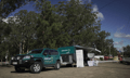
“This new capability is the first step towards a system where technology will allow those affected by a disaster to simply confirm their situation rather than report it. This takes a huge burden off those affected,” said DAS CEO Anthony Willmott (pictured above).
The system draws from Geoscience Australia’s bushfire boundary data, which updates every 15 minutes, along with information from state emergency services and government agencies. This integration provides a clearer picture of fire damage beyond just location and spread, allowing organisations to assess the number of affected buildings and policyholders.
“Knowing which of your customers are impacted is at the heart of being a great insurer, lender or government body. All of our clients are committed to building safer regional communities and they can now see the impact in real time,” Willmott said.
With precise data on fire damage, insurers can process claims faster, financial institutions can provide targeted assistance and government agencies can direct resources where they are needed most.
“It will also allow financial institutions and those offering support to the fire affected to more accurately target their assistance and triage those greatest in need, whether that’s government-led or empowering insurers to rapidly pinpoint number of building or structures damaged or lost, part of efforts to make climate event data more accessible at a portfolio level,” Willmott said.
DAS’s technology builds on its work with organisations like Insurance Facilitators, IAG, and fire authorities such as the NSW Rural Fire Service and the Country Fire Service (CFA) across five states. The company also provides cropping and harvesting data to fire services to help predict how fires may spread.
Since its launch in 2017, DAS has focused on climate and fire risk analysis, offering free baseline property assessments for agricultural producers. The company’s models incorporate data from more than 109,000 ground-truth locations, including over 13,000 from 2024.