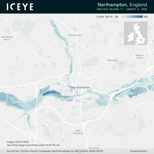
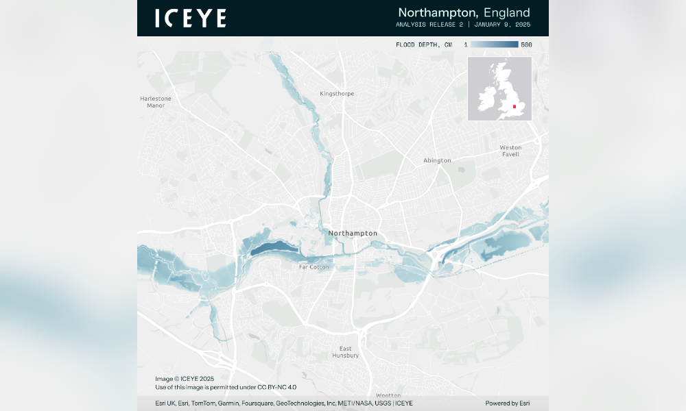
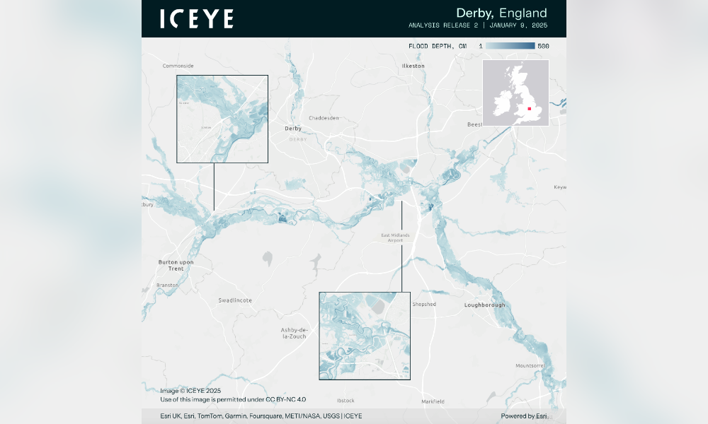
Following significant flooding in the UK Midlands from 6 to 8 January, ICEYE has provided an update on the scale of the damage.
The company’s analysis, based on 16 SAR (synthetic aperture radar) image acquisitions, reports a total flooded area of 1,153 square kilometres, with at least 7,000 buildings impacted. The mean flood depth recorded is 25 cm.
ICEYE, which operates synthetic aperture radar (SAR) satellite constellation, has been monitoring the affected regions closely. The company stated that its team is concentrating efforts on the most severely impacted areas. It also noted that further analysis of the event’s impact on individual buildings will be released as more data is captured.
The company’s technology allows for near real-time flood monitoring, providing crucial data on the extent, depth, and duration of floods within hours of their peak.
Last year, ICEYE launched two new solutions, Flood Early Warning and Flood Rapid Impact, designed for the UK insurance market to improve customer resilience and reduce flood-related claim costs.
The flood event in the Midlands has prompted widespread attention to the growing need for timely, accurate flood monitoring systems. With increased weather-related events, ICEYE’s satellite technology plays a role in providing insights that support quicker decision-making for both disaster response and recovery operations.
In addition to ICEYE’s efforts, the Environment Agency has been actively managing the response to the flooding. According to a news story published by the Environment Agency, as of 10 January, 24 flood warnings and 72 flood alerts were in effect across England. Over 77,000 properties have been protected from flooding, but approximately 1,400 homes have been impacted since New Year’s Eve.
Read next: One in four UK properties at risk of flood
The BBC reported that in addition to the flooding, snow and ice warnings were issued across the country, adding further challenges to the response efforts.
As more data becomes available, ICEYE will continue to monitor the situation, with further analysis expected in the coming days.
How do you think satellite technology and flood defences can improve flood response efforts? Share your thoughts in the comments below.