Updated wildfire hazard maps from the California Department of Forestry and Fire Protection (Cal Fire) will not affect insurance rates or coverage availability, according to a report from AM Best, citing the California Department of Insurance (CDI).
“Insurance companies are already using risk analysis tools and models that go beyond Cal Fire’s proposed maps in determining what properties they will underwrite,” the department said in a statement.
Insurance Commissioner Ricardo Lara said the maps “are not used for insurance rates or underwriting decisions,” but are meant to provide communities with more detailed information on wildfire hazards. The state fire marshal is required to classify land within State Responsibility Areas into fire hazard severity zones—moderate, high, or very high.
The maps evaluate hazard rather than risk, according to the fire marshal, using a method similar to flood zone mapping. They estimate the likelihood of wildfire based on factors such as topography, vegetation, wind patterns, ember production and movement, climate conditions, and fire history, without predicting specific outcomes.
Cal Fire continues to revise the maps, most recently updating data for parts of Southern California. The updates include areas impacted by wildfires earlier this year.
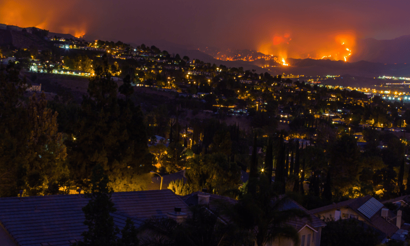
In January 2025, multiple fires broke out across Ventura, Los Angeles, and San Diego counties, prompting evacuations, destroying structures, and straining emergency response resources. The fires were fueled by dry vegetation and strong Santa Ana winds, marking one of the earliest major fire events in recent years.
“These maps are intended to guide local planning decisions, not insurance decisions,” said CDI spokesperson Michael Soller.
“The reality is we all need to do more to protect our homes and communities from wildfires,” Lara said in a statement.
In March, CDI released updated lists of distressed counties and underserved ZIP codes. These lists help determine insurer participation in residential property coverage as part of broader efforts to address challenges in California’s insurance market.
CDI is also reviewing wildfire catastrophe models for use in rate filings for the first time. Verisk submitted a model earlier this year for consideration, according to the report.
As part of a regulatory overhaul, insurers seeking rate changes must commit to writing more policies in wildfire-prone areas. This can be done by maintaining at least 85% of their statewide market share in those areas or increasing coverage there by at least 5%.
Commercial insurers, including those covering farms, condominium associations, and businesses, are required to expand their presence in designated areas by 5%. The regulation includes provisions aimed at limiting cost increases for policyholders.
In an online Q&A, CDI explained that Cal Fire’s maps are designed to identify long-term wildfire hazards and assist with state and local resource allocation.
“Expanded state grant programs and Commissioner Lara’s new wildfire safety regulation are aimed at reducing wildfire risks to communities through programs such as Firewise USA and the new Fire Risk Reduction Community designation from the California Board of Forestry and Fire Protection,” the department said.
CDI plans to update the distressed counties and underserved ZIP code lists annually. Any future changes to Cal Fire’s hazard maps will be reflected in those updates, Soller said.