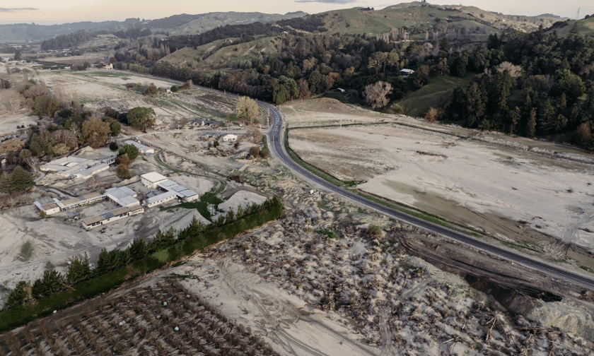
Two years after Cyclone Gabrielle devastated New Zealand’s North Island, the Hawke’s Bay Regional Council has released a map detailing the full extent of flooding across the region. The map aims to support flood mitigation efforts and provide residents with key information for decision-making.
The council stated that the map – created using aerial photographs, satellite images, video footage, local council building inspection reports, and ground contour data – does not necessarily reflect the specific damage sustained by individual properties during the storm. However, it offers a visual representation of the areas affected by flooding when the Ngaruroro River burst its banks in February 2023.
The decision to publish the map follows requests from residents seeking clarity on the extent of flooding. The council emphasised that while the map will be included in Land Information Memorandum (LIM) reports, it remains uncertain whether it will impact insurance premiums.
“In some areas, the return period of the flow in the river during Cyclone Gabrielle was in the order of 1:300 years to over 1:1000 years,” a council spokesperson said. “The insurance industry, in contrast, generally uses flood hazard maps derived from a modelled event such as a 1:100-year flood to determine the risk profile.”
Authorities have cautioned against using the map as the sole basis for evaluating flood risk and urged residents to seek independent advice regarding potential implications for their properties.
Cyclone Gabrielle, which struck in February 2023, remains the costliest tropical cyclone on record in the Southern Hemisphere, with total damages reaching$14.5 billion, a report from RNZ noted. It was also the deadliest weather event in New Zealand’s history, with Hawke’s Bay among the hardest-hit regions. The storm resulted in the deaths of eight people, the evacuation of 9,000 residents, and the red-sticker designation of 83 buildings.
Do you have something to say about the new map recently released? Share your thoughts in the comments below.